Satellite Images Appear to Show Three US KC-135 Tankers Destroyed at Saudi Base, Escalating Iran-US Air War
Newly circulated commercial satellite imagery from Prince Sultan Air Base appears to reveal the destruction of three KC-135 Stratotanker refuelling aircraft, raising urgent questions about the vulnerability of American airpower logistics in the Gulf.

(DEFENCE SECURITY ASIA) — Commercial satellite imagery released on March 27 has transformed a previously disputed Iranian strike against Prince Sultan Air Base into one of the most strategically consequential episodes of the expanding United States-Iran confrontation.
The imagery appears to show three KC-135 Stratotanker aerial refuelling aircraft destroyed on the flight line at Al-Kharj, while several additional aircraft display visible signs of heavy damage.
If verified, the apparent loss of multiple tanker aircraft would represent one of the most damaging single attacks against American airpower infrastructure in Saudi Arabia since regional hostilities intensified.
Pro-Iranian accounts declared that the satellite images proved the “destruction of 3 KC-135 refueling aircraft and serious damage to several others” at the American military installation.
The images emerged during an Iranian retaliatory campaign linked to “Operation True Promise 4,” which increasingly shifted from symbolic strikes toward attacks against American logistical infrastructure.
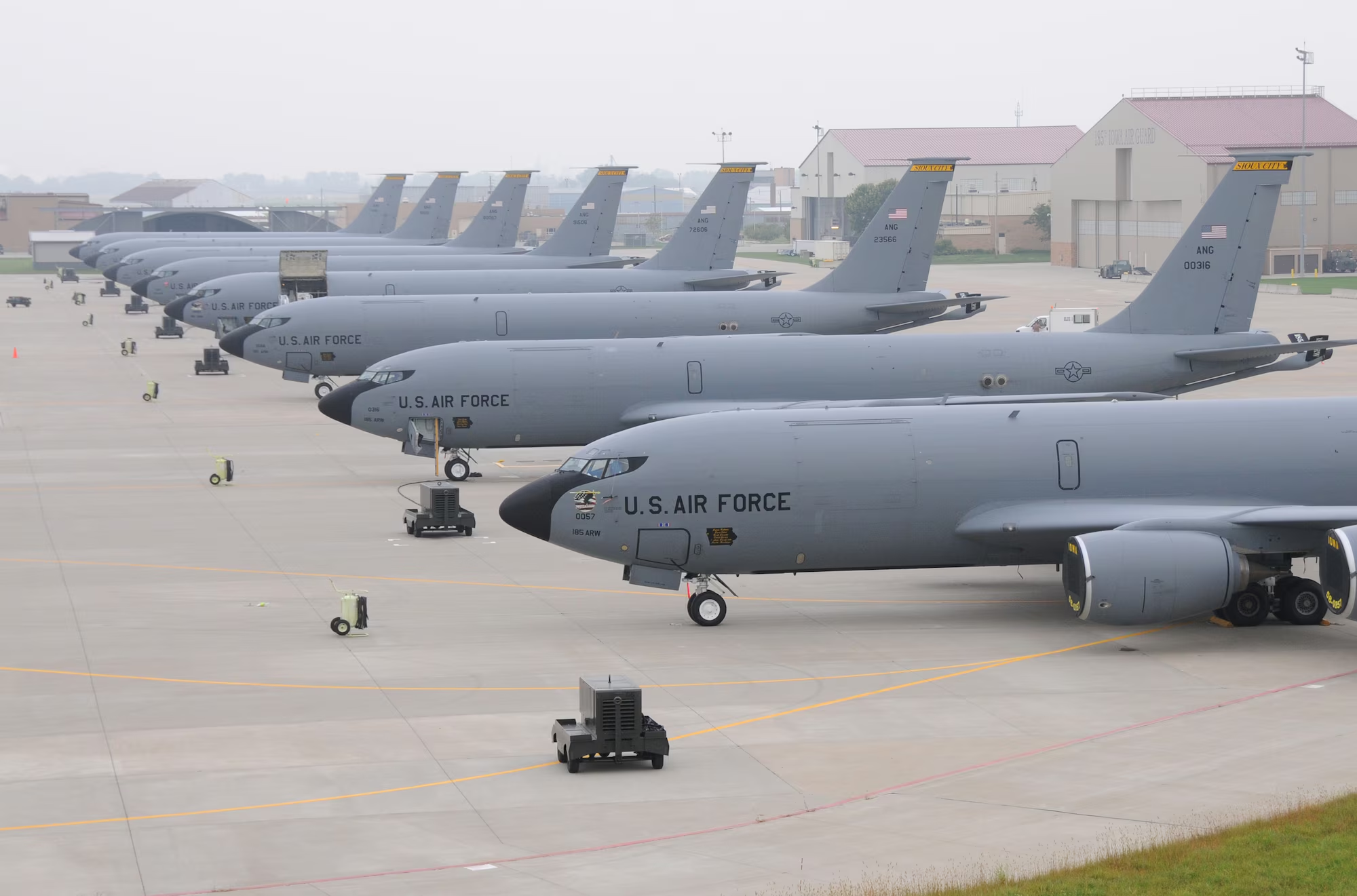
Prince Sultan Air Base, also known as Al-Kharj Air Base, has functioned as one of the most important American operational hubs supporting regional combat operations.
The controversy surrounding the imagery widened because Western reporting described approximately five damaged aircraft, while Iranian-linked accounts insisted three KC-135 tankers had been completely destroyed.
That contradiction immediately elevated the incident from a routine battle damage claim into a broader strategic contest over credibility, vulnerability, and deterrence.
Commercial imagery shared across social media included side-by-side comparisons showing the same aircraft parking area before and after the reported strike.
Several widely circulated accounts argued the damage represented proof that Iranian missile and drone forces can now threaten heavily defended American installations across the Gulf.
Sceptics, however, argued the same imagery remained unauthenticated, potentially manipulated, and insufficient to establish whether the aircraft were destroyed, heavily damaged, or still recoverable.
The debate acquired wider significance because the aircraft allegedly struck were not combat aircraft but aerial refuelling platforms supporting the entire American regional air campaign.
A successful strike against such aircraft would therefore carry disproportionate consequences for logistics, operational endurance, and future American force posture across the Middle East.
READ: US Evacuates KC-135 Tankers From Saudi Air Base After Iranian Missile Barrages Expose Gulf Air-Defence Weakness
Satellite Images Centre on Three Burned Aircraft Positions
The most widely distributed composite image showed a “before attack” frame containing multiple KC-135 aircraft parked in clearly identifiable positions across the tarmac.
The corresponding “after attack” frame showed large blackened burn scars and dense debris patterns occupying the same parking positions highlighted previously.
Three aircraft positions were marked with red circles by pro-Iranian accounts, which asserted these locations represented complete destruction of the refuelling aircraft.
Additional aircraft parking positions were enclosed in yellow circles, indicating what Iranian-aligned accounts described as serious damage or partial strike effects.
The images were reportedly derived from Sentinel-2 commercial satellite coverage dated March 27 and rapidly circulated across Persian and Arabic-language platforms.
Several close-up images accompanying the main composite included visible smoke plumes, darkened surface scarring, and possible impact points surrounding the parking apron.
Some versions of the imagery also included thermal-style overlays intended to emphasise areas allegedly struck during the Iranian attack.
The concentration of damage within a tightly defined section of the flight line reinforced Iranian claims that the strikes deliberately targeted parked refuelling aircraft.
Unlike earlier wartime imagery showing dispersed damage across wide areas, the Al-Kharj photographs suggested repeated impacts against a narrowly concentrated operational objective.
That pattern encouraged speculation that the strike package may have been programmed specifically against the tanker parking area rather than the broader air base.
The images also appeared to show that the most heavily affected aircraft were positioned close together, increasing the probability of secondary fire and fragmentation damage.
Such clustering would explain why some aircraft appeared completely destroyed while others showed only partial burn signatures or surrounding blast effects.
The visual evidence nonetheless remained limited because the available satellite resolution could not conclusively distinguish between destroyed aircraft, burned support vehicles, or heavily scorched parking positions.
Even so, the appearance of multiple burn scars across the same section of the flight line created a powerful visual narrative that rapidly spread across global social media.
Geolocation Markers Intensify Claims of Precision Iranian Targeting
Additional social media posts distributed alongside the satellite images included precise geolocation coordinates identifying the damaged area at 24.063313, 47.563749.
Those coordinates correspond to the aircraft parking section at Prince Sultan Air Base where American support aircraft have routinely been positioned.
Iranian-linked accounts argued that the geolocation data strengthened their assertion that the imagery represented an authentic post-strike assessment.
The posts also claimed the strike demonstrated a growing Iranian capacity to conduct precise missile and drone attacks against distant regional targets.
Some accounts supplemented the satellite images with separate footage purporting to show impact sequences or additional post-strike damage.
The same accounts described the operation as part of a broader retaliatory campaign directed against American military infrastructure supporting regional combat operations.
Because the affected aircraft were positioned in the open, the images intensified questions regarding the protective posture surrounding American support assets.
The apparent concentration of damage around tanker parking areas suggested the strike may have been designed specifically to disrupt American aerial refuelling capability.
Iranian accounts repeatedly emphasised that the attack formed part of “Operation True Promise 4,” which they portrayed as an increasingly precise retaliatory campaign.
Within that narrative, the strike against Al-Kharj was presented not merely as a tactical success but as a demonstration of changing regional power balances.
The use of exact geolocation markers served an additional purpose because it encouraged outside observers to independently compare the coordinates with publicly available imagery.
That approach attempted to create an impression of transparency and authenticity around the Iranian claims despite the absence of formal independent verification.
At the same time, critics argued that geolocation alone cannot establish what actually occurred at the identified location or determine the true extent of the damage.
The disagreement therefore centred not on whether the images corresponded to Prince Sultan Air Base, but on whether the visible scarring genuinely represented destroyed KC-135 aircraft.
Some sceptical accounts argued that the visible burn marks could reflect damaged equipment, fires, or post-strike clean-up activity rather than complete aircraft losses.
Others questioned whether the aircraft circled in the “before” imagery and the scorched positions in the “after” imagery corresponded precisely to the same locations.
Even so, the inclusion of exact coordinates transformed the imagery from a vague online allegation into a more technically detailed claim demanding closer scrutiny.
KC-135 Losses Would Directly Undermine American Air Operations
The KC-135 Stratotanker remains one of the most important logistical platforms supporting American military aviation throughout the Middle East.
These aircraft enable fighters, bombers, surveillance platforms, and transport aircraft to sustain long-duration operations across large regional distances.
Any confirmed loss of three KC-135 aircraft would therefore create consequences extending far beyond the immediate damage visible at Prince Sultan Air Base.
The destruction of tanker aircraft on the ground would reduce operational flexibility, complicate sortie generation, and force American planners to redistribute remaining assets.
Serious damage to several additional aircraft would further increase pressure on the available tanker fleet supporting operations throughout the region.
The apparent strike therefore carried significance beyond symbolic messaging because it targeted a critical logistical component of American regional force posture.
Iranian accounts presented the attack as evidence that vulnerable support aircraft can be struck even within major American military facilities.
That narrative was intended to signal that future Iranian retaliatory waves could target the logistical architecture sustaining broader American air operations.
The loss of tanker aircraft would be particularly significant because refuelling platforms enable the United States to project airpower across vast distances without relying exclusively on nearby bases.
A reduction in available refuelling capacity would force American aircraft either to operate closer to their bases or accept reduced mission duration.
Such constraints would become especially important during a sustained regional conflict involving simultaneous operations across multiple theatres.
Prince Sultan Air Base has been used as a major support node for American regional activity, making any damage there strategically more important than a comparable incident elsewhere.
A strike that permanently removed even a small number of tanker aircraft could therefore impose operational consequences disproportionate to the number of aircraft lost.
The incident also highlighted the continuing vulnerability of high-value support aircraft parked in open areas without hardened protection.
Unlike combat aircraft designed for survivability in contested airspace, tanker aircraft are large, slow, and difficult to conceal or rapidly disperse.
Their destruction on the ground would therefore represent one of the most efficient ways to degrade American air operations without directly confronting American combat aircraft.
Even if only temporarily damaged, the aircraft would still require maintenance, inspection, and possible relocation, further complicating operational planning.
Conflicting Accounts Reveal Deep Information Warfare Divide
The satellite imagery immediately became the centre of an escalating information battle between Iranian narratives and Western reporting.
Iranian-aligned accounts consistently stated that three KC-135 aircraft had been destroyed and that several others suffered major secondary damage.
Western and American reporting, however, described the same incident as causing damage to approximately five aircraft rather than complete destruction.
That discrepancy created a fundamental dispute over whether the affected tankers were operationally recoverable or permanently lost.
Neither side produced publicly available independent verification capable of conclusively determining the true scale of aircraft losses.
The commercial imagery itself showed visible burn marks and damage patterns, yet remained insufficient to establish definitive aircraft condition.
As a result, the satellite photographs became less important as evidence than as instruments within a broader strategic messaging contest.
Both sides used the images to reinforce competing narratives concerning Iranian strike effectiveness and American military resilience.
Iranian-linked accounts framed the imagery as proof that their missile and drone forces can penetrate American defensive systems and inflict meaningful operational losses.
That message carried broader strategic value because it supported Iranian claims that future retaliation could impose even greater costs on American regional deployments.
Western reporting adopted a more cautious interpretation, emphasising damage rather than destruction and avoiding definitive conclusions concerning the number of aircraft affected.
That more limited assessment supported a competing narrative in which the attack remained serious but failed to produce a decisive operational effect.
The dispute illustrated how modern military conflicts increasingly involve parallel struggles over perception, interpretation, and narrative dominance.
Commercial satellite imagery has become especially important within that contest because it provides apparently objective evidence that can nonetheless be interpreted in different ways.
The same photograph can therefore simultaneously support claims of catastrophic losses, limited damage, or even deliberate exaggeration depending on the observer.
The Al-Kharj imagery became particularly influential because the visual appearance of dark burn scars and missing aircraft positions created a dramatic impression even before independent analysis occurred.
That impression spread rapidly across social media platforms where images often carry greater persuasive power than cautious technical assessments.