Russia Accused of Purchasing American Satellite Images to Precisely Target Ukrainian Military Assets
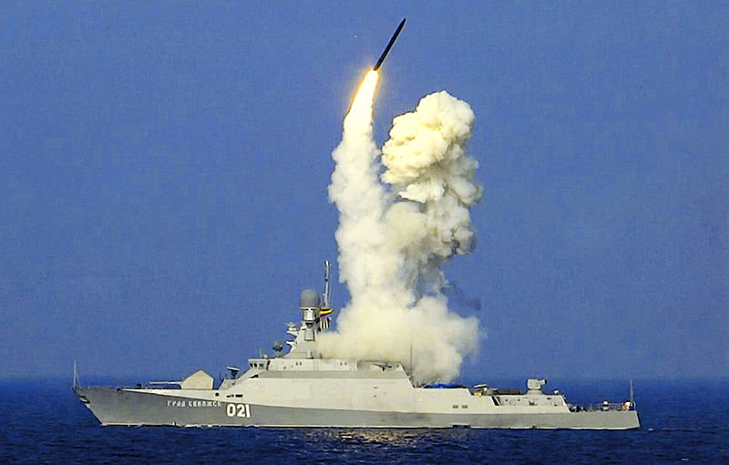
Russia is accused of utilizing satellite imagery purchased from American satellite companies by interested third-party companies to aid in the precise targeting of its cruise missiles, striking Ukrainian military assets and infrastructure.

(DEFENCE SECURITY ASIA) — Russia is accused of utilizing satellite imagery purchased from American satellite companies by interested third-party companies to aid in the precise targeting of its cruise missiles, striking Ukrainian military assets and infrastructure.
The allegation by Ukraine asserts that these satellite images were procured by third-party companies for use by the Russian military.
The involvement of these third-party companies aims to obfuscate the role played by Russia in utilizing these commercial satellite images for military purposes and to evade economic sanctions imposed against it.
According to sources within Ukraine, as reported by The Atlantic, satellites will capture images of the targeted locations, and within days or weeks, Russian guided missiles will strike these locations.
The purchase of satellite images of the targeted locations will likely occur again shortly after the attacks, possibly for post-strike analysis purposes.
“It cannot be coincidental anymore because it has happened too frequently, allowing it to be clearly intentional and carried out by interested parties,” the source added.
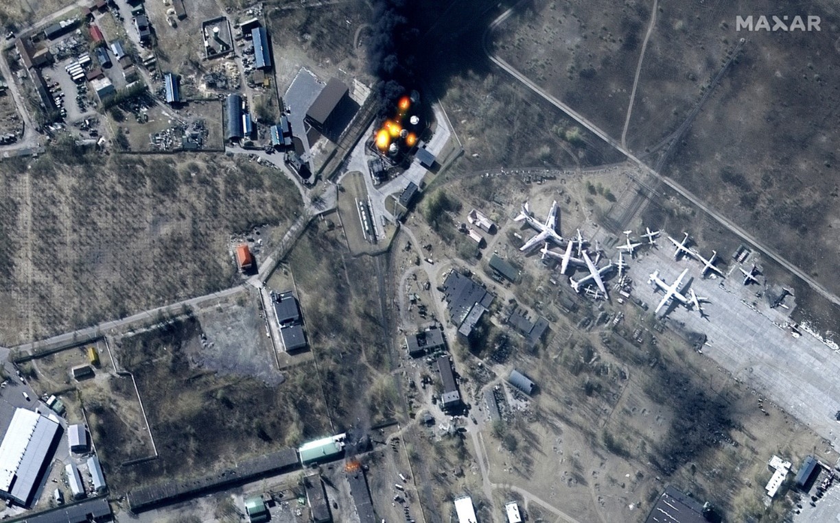
On April 2, 2022, the Mirgorod region in Ukraine was struck by Russian guided missiles, and American companies had requested to purchase satellite images of that area nine times before the attack occurred.
The purchase of satellite images of the targeted locations was repeated again several days after the attack.
Similarly, on March 26, 2022, a missile factory in Kiev was targeted by Russia, and as with the Mirgorod incident, American companies had purchased satellite images of the factory location prior to the attack.
These companies also acquired satellite images of the factory location after the missile attack, likely for post-attack analysis.
The source further claims that hundreds of “suspected” satellite image purchases have occurred, indicating the involvement of third parties collaborating with satellite service providers such as Maxar and Planet Lab to assist the Russian military in its military campaign in Ukraine.
These allegations are supported by Ukraine’s Deputy Minister of Defense, Kateryna Chernorenko, with sources informing local media that third-party purchases of satellite images have increased over the past six months.

High-resolution satellite images are crucial as they reveal significant information about the surrounding geography of an area, such as mountains, rivers, forests, and structures, including roads and bridges.
Understanding the surrounding conditions is essential for analyzing the effects of guided missile attacks and adjusting strategies.
Satellite images can also reveal the presence or absence of military assets or infrastructure such as missile launch sites, military bases, radar systems, and various other infrastructures.
The size, shape, and location of these military assets and infrastructure can provide information about their capabilities and importance.
Finally, after the guided missile strikes, satellite images can reveal the extent of the damage incurred, especially at the strike sites, the destruction of buildings, or various other signs of destruction.
This will aid in analyzing the effectiveness of the attack and whether further follow-up attacks are warranted. – DSA
