India’s ‘Unsinkable Aircraft Carrier’? Great Nicobar Emerges as New Strategic Weapon Against China’s Expanding Indian Ocean Footprint
India’s US$10 billion (RM38 billion) Great Nicobar mega-project is rapidly evolving into a dual-use strategic fortress positioned near the Malacca Strait, potentially reshaping Indo-Pacific force posture and challenging China’s regional maritime expansion.

(DEFENCE SECURITY ASIA) — The transformation of Great Nicobar Island into a dual-use strategic hub is rapidly emerging as one of the Indo-Pacific’s most consequential geopolitical developments because it places India at the geographic hinge point connecting the Indian Ocean and the Western Pacific.
As strategic competition between India and China intensifies across maritime corridors, the project’s significance increasingly extends beyond infrastructure development into a broader contest over sea-lane control, logistics dominance, and long-term regional force posture.
Analysts cited in recent strategic assessments argue that Great Nicobar offers India a sovereign and naturally advantageous military position capable of influencing strategic calculations surrounding the Malacca Strait, through which approximately 80 percent of China’s oil imports and significant trade flows transit annually.
The project, valued at approximately US$9–10 billion or RM34.2 billion–RM38 billion, has increasingly been framed as India’s geographic response to China’s expanding maritime presence and Beijing’s widening network of strategic access points across the Indian Ocean Region.
Strategic commentary linked to former Indian military leadership, including former Air Chief Marshal R.K. S. Bhadauria and retired Lieutenant General Rajeev Chaudhry, has described the initiative as a structural response to China’s growing operational footprint and its long-discussed “Malacca Dilemma.”
The development effort also introduces a strategic variable that some analysts believe Chinese-supported ports across the region may struggle to replicate because India possesses sovereign control over naturally positioned geography rather than externally negotiated access arrangements.
The initiative therefore increasingly represents not merely an infrastructure undertaking but an attempt to reshape regional maritime power geometry through logistics infrastructure, surveillance architecture, and integrated military-economic positioning.
These assessments increasingly suggest that Great Nicobar is being viewed not only as a maritime infrastructure project but also as a strategic instrument designed to alter operational assumptions across the eastern Indian Ocean and adjacent Indo-Pacific theatres.
The island’s geographic placement near critical sea lines of communication potentially allows India to integrate logistics support, maritime surveillance networks, and forward-deployment infrastructure into a single strategic ecosystem with substantial regional implications.
Unlike externally dependent access arrangements that may fluctuate according to diplomatic circumstances, sovereign control over Great Nicobar provides India with a more predictable long-term foundation for military planning and strategic signalling activities.
The broader geopolitical significance of the initiative also lies in its timing, as Indo-Pacific powers increasingly compete to secure strategic maritime corridors amid intensifying concerns regarding supply-chain security and contested regional influence.
As regional military planners increasingly prioritize logistics resilience and maritime domain awareness, Great Nicobar may ultimately emerge as one of the most strategically consequential force-multiplier projects shaping the future balance of power across the Indian Ocean Region.
The Geography Of Great Nicobar Alters Indo-Pacific Strategic Equations
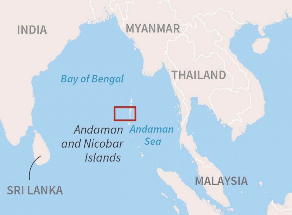
Great Nicobar occupies one of the most geographically consequential locations in the Indian Ocean because it sits near the western approaches of the Malacca Strait and overlooks vital maritime traffic arteries connecting Asia with global markets.
The island’s southern position within the Andaman and Nicobar chain creates a strategic observation point across maritime corridors that carry substantial portions of international trade and energy shipments.
Strategic assessments increasingly characterize the island as a natural forward operating platform capable of influencing operational calculations during periods of heightened geopolitical tension.
Unlike constructed strategic outposts elsewhere across Asia, Great Nicobar’s advantages emerge from permanent sovereign geography that carries no contested territorial status.
This distinction potentially provides India with a stable long-term strategic asset without inheriting the diplomatic complications associated with disputed maritime structures.
Analysts describe the location as a form of natural aircraft carrier because geographic positioning alone creates operational advantages unavailable through conventional infrastructure investment alone.
Its location near the Six Degree Channel further increases its relevance because this route functions as a major artery for commercial and naval movements entering and exiting the Malacca corridor.
Integration with wider Indian military architecture may eventually create expanded monitoring capacity capable of supporting maritime domain awareness across wider Indo-Pacific sectors.
Such positioning therefore enhances both operational visibility and broader deterrence calculations during periods of strategic uncertainty.
China’s “String of Pearls” Strategy Has Intensified India’s Maritime Calculations
Strategic discussion surrounding Great Nicobar increasingly links the project with China’s widely discussed “String of Pearls” approach across the Indian Ocean Region.
That framework generally refers to a network of Chinese-linked maritime infrastructure projects extending from East Asia toward the Middle East and Africa.
Frequently cited locations include Gwadar in Pakistan, Hambantota in Sri Lanka, and Kyaukpyu in Myanmar, each occupying geographically important maritime positions.
These facilities are often interpreted by analysts as supporting wider Chinese interests involving supply chains, logistics resilience, and strategic access across maritime corridors.
Indian strategic thinkers increasingly argue that cumulative Chinese infrastructure investments create pressure on India’s long-term security calculations throughout surrounding maritime approaches.
Great Nicobar therefore increasingly appears positioned as part of India’s wider “Necklace of Diamonds” strategy intended to counter potential strategic encirclement dynamics.
Rather than responding through overseas basing agreements, India appears focused on leveraging domestic geographic assets possessing strategic utility.
This approach potentially reduces political dependency risks while simultaneously expanding indigenous operational flexibility during crises.
The broader competition therefore increasingly revolves around geographic leverage and logistics architecture rather than purely naval fleet numbers.
The Great Nicobar Project Combines Military Utility With Economic Infrastructure
The Great Nicobar Island Development Project extends beyond military implications because its broader design seeks to create integrated economic and logistics infrastructure supporting regional connectivity.
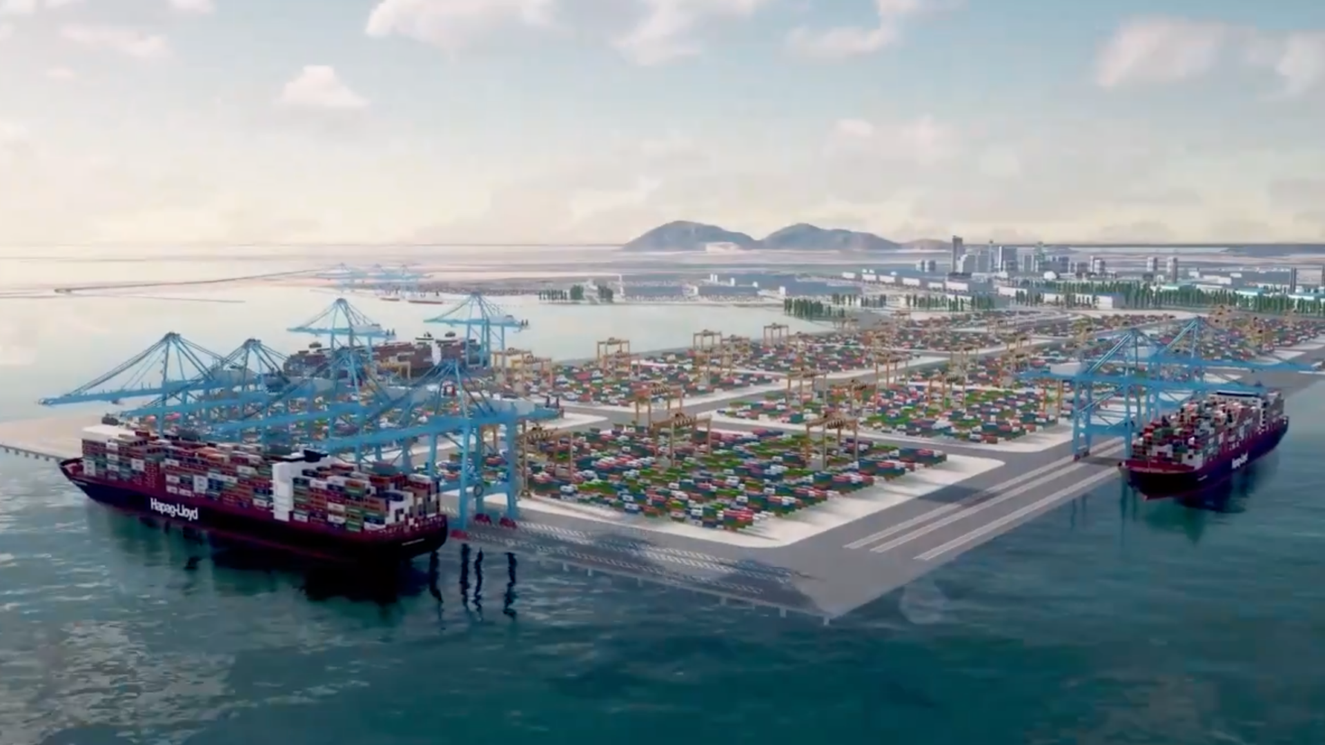
Official planning envisions the transformation of the island into a major maritime and transshipment node capable of supporting international shipping activity.
The initiative, formally identified as the Holistic Development of Great Nicobar Island and linked with the Galathea Bay International Container Transshipment Terminal, forms a central component of this strategy.
Estimated project costs ranging between US$9–10 billion or RM34.2 billion–RM38 billion indicate substantial long-term investment commitment by New Delhi.
Strategic assessments increasingly describe infrastructure design as dual-use because civilian facilities may simultaneously enhance logistics resilience and military utility.
Advanced logistics systems involving artificial intelligence integration, smart-port technologies, and sustainable infrastructure concepts are reportedly expected to form part of future development phases.
Analysts argue that infrastructure resilience increasingly represents a strategic capability rather than purely an economic instrument across contested regions.
The project also seeks to improve broader connectivity links with Southeast Asian economies and maritime supply networks.
Its strategic utility therefore emerges from the convergence of military posture and economic influence rather than either factor independently.
Maritime Surveillance Could Become Great Nicobar’s Quiet Strategic Advantage
The surveillance implications surrounding Great Nicobar increasingly attract attention because maritime awareness capability now represents one of the most decisive factors shaping Indo-Pacific competition.
A developed operational architecture integrated with existing command structures could theoretically provide enhanced visibility across naval and commercial movements.
The Six Degree Channel possesses particular relevance because it serves as an important route traversed by commercial shipping and military vessels.
Persistent maritime monitoring capability could potentially improve situational awareness across one of the world’s busiest maritime environments.
Such capabilities become strategically valuable because modern maritime competition increasingly depends upon information dominance rather than kinetic capability alone.
Enhanced awareness may also strengthen force deployment efficiency and improve broader operational decision-making processes during emerging crises.
Real-time maritime monitoring increasingly functions as strategic leverage because it shapes planning assumptions among competing actors.
Analysts therefore suggest that geographic position combined with surveillance architecture could generate influence disproportionate to territorial size alone.
Strategic utility increasingly depends not merely on location but on integration between sensors, infrastructure, and operational command systems.
Environmental And Strategic Trade-Offs Continue To Shape Debate Around The Project
Despite strategic enthusiasm surrounding Great Nicobar, the initiative continues facing scrutiny regarding environmental and social implications associated with large-scale infrastructure expansion.
Environmental clearance had previously been granted, while India’s National Green Tribunal upheld approval during February 2026 while simultaneously imposing compliance obligations.
Tribunal directives reportedly included coral protection requirements, shoreline preservation measures, and safeguards involving turtle nesting ecosystems.
The balancing challenge therefore increasingly involves reconciling environmental sustainability with strategic urgency and national security priorities.
Large infrastructure initiatives frequently create trade-offs involving ecological disruption, local communities, and long-term environmental resilience.
Strategic projects increasingly face heightened examination because environmental legitimacy now influences political sustainability and international perception.
Infrastructure construction activities, detailed project planning, and bid processes reportedly continue advancing through various implementation stages.
The first commissioning phase is currently expected around 2028, while broader development could continue extending across several decades.
Great Nicobar therefore represents a high-risk and high-reward strategic undertaking whose ultimate significance may depend upon execution as much as geographic potential itself.
As Indo-Pacific strategic competition increasingly shifts toward logistics networks and geographic leverage, Great Nicobar may ultimately become less about infrastructure and more about who shapes the future architecture of Asian maritime power.