Torpedo-Like Object Found on Kuala Terengganu Beach — Could It Be a Military-Grade Underwater Drone (UUV) ???
Is the torpedo-like object discovered by members of the public along the shores of Pantai Seberang Takir, Kuala Terengganu, in fact an Unmanned Underwater Vehicle (UUV) — a dual-use system capable of serving both marine scientific research and military reconnaissance purposes?

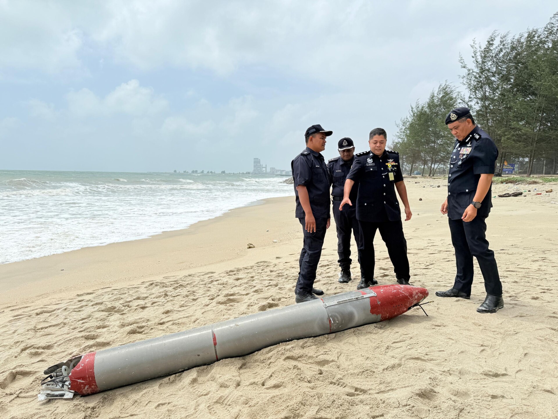
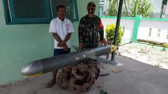
(DEFENCE SECURITY ASIA) — In what may be a significant clue pointing to growing unmanned surveillance activity in Southeast Asian waters, a mysterious metallic object resembling a torpedo was discovered early this morning along the shores of Pantai Seberang Takir, Kuala Terengganu — a coastal stretch that faces directly into the increasingly militarised South China Sea.
The cylindrical device, measuring approximately 2.7 metres in length and weighing an estimated 70 kilograms, was found by a member of the public at around 7.30am.
The incident was swiftly reported to local authorities, according to Malaysia’s national news agency, Bernama.
Kuala Terengganu District Police Chief ACP Azli Mohd Noor confirmed that his department received an emergency call from a civilian who had stumbled upon the suspicious object.
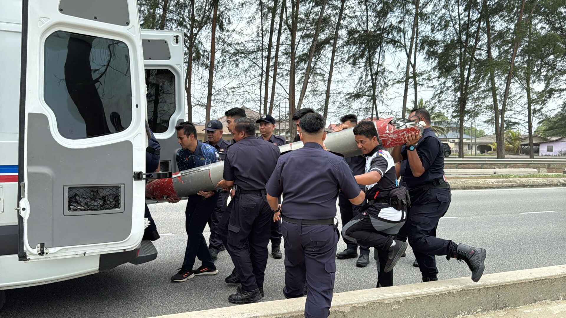
Responding bomb disposal units were deployed to the site, where initial fears of a possible explosive were later ruled out.
A detailed examination revealed the presence of extensive internal wiring, but tests confirmed the absence of any explosive material or harmful radioactive substances.
Instead, authorities concluded that the object was a sophisticated marine research instrument, reportedly valued at around RM1 million.
“Instead, it has been identified as a marine research instrument, estimated to be worth around RM1 million,” ACP Azli said, adding that the device was likely carried ashore by powerful currents associated with the seasonal Northeast Monsoon (MTL).
“We have yet to determine the owner. There are no visible markings indicating corporate ownership, but we believe it may belong to a local university,” he told Bernama.
However, open-source imagery and the device’s dimensions bear a striking resemblance to Underwater Unmanned Vehicles (UUVs) — autonomous underwater drones commonly used for maritime data collection but also equipped with capabilities that raise red flags in the defence and intelligence communities.
This is not an isolated occurrence.
Between 2019 and 2020, similar torpedo-shaped devices were retrieved by fishermen in Indonesia and the Philippines.
Experts later identified these as Sea Wing-type ocean gliders, manufactured by Chinese state-linked institutions.
These UUVs — often deployed under the guise of scientific research — have dual-use potential, capable of mapping the seabed, tracking undersea cables, or even preparing navigational routes for stealth submarine operations.
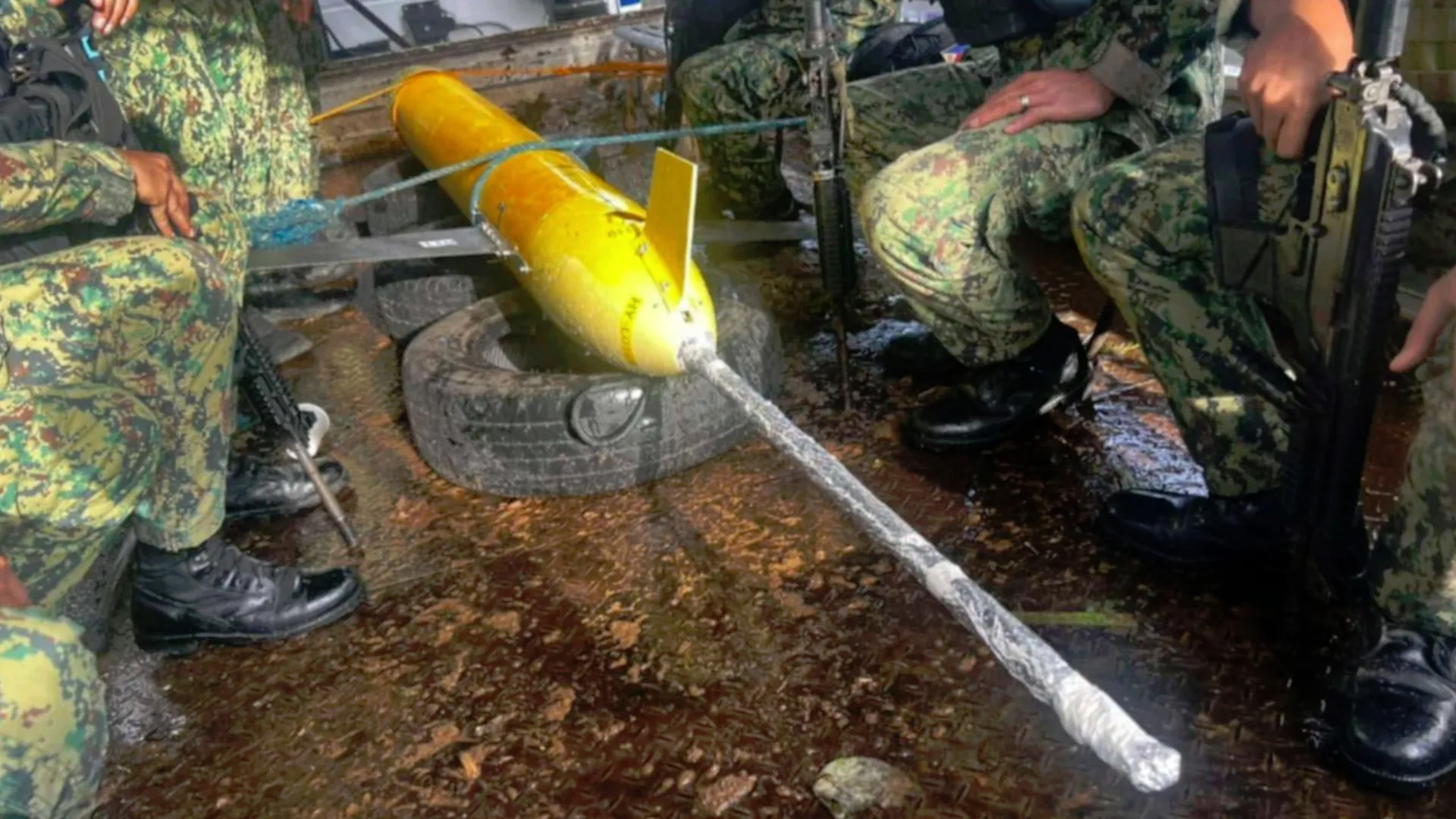
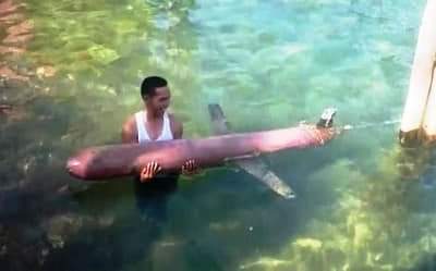
In the most recent incident before Terengganu, a Filipino fisherman recovered a suspected UUV on 30 December 2024, roughly six nautical miles off the coast of San Pascual, Masbate, a province strategically located near the Philippine Sea and the Sibuyan Sea, key transit points for regional naval movement.
The two-metre-long drone was handed to the Philippine National Police (PNP) and later transferred to the Philippine Navy for forensic analysis.
Images of the recovered drone showed clear markings — “HY-119” and “HY-L0119” — suggesting possible Chinese origin.
According to Brig. Gen. Andre Dizon, regional director of PNP Bicol, initial open-source analysis points to a Chinese-manufactured system.
“The object has an antenna and an optical lens for visual observation. Based on the data we found, it is likely designed for monitoring and reconnaissance purposes,” Dizon said.
Experts believe the “HY” series could be linked to China’s expansive efforts in building underwater situational awareness, particularly through its Sea Wing ocean glider, developed by the Chinese Academy of Sciences (CAS).
Designed for long-duration deployment, this UUV can reportedly operate autonomously for up to 30 days and dive as deep as four nautical miles, enabling it to chart critical undersea terrain or monitor naval activity discreetly.
These capabilities are not merely theoretical. On 19 January 2021, fishermen in Air Putih, Pulau Anambas — a location not far from Malaysia’s maritime borders — recovered a 1.5-metre, 25-kilogram blue drone with faded Chinese characters.
Submarine warfare analyst H I Sutton, writing on his Covert Shores platform, concluded that the object was likely a Chinese underwater sensor, potentially used for remote sensing or underwater radio telemetry.
Another incident in December 2020 saw an Indonesian fisherman, identified as “Saeruddin”, recover a similar Sea Wing-type drone near Pulau Selayar, South Sulawesi — alarmingly close to the Sunda Strait, a key maritime chokepoint.
The discovery led analysts to speculate that China may be clandestinely mapping alternative submarine corridors from the South China Sea to the Indian Ocean, bypassing the congested and strategically sensitive Strait of Malacca.
Such activity would align with China’s long-term maritime strategy, particularly in the event of naval confrontation or a strategic blockade that renders the Malacca Strait unusable.
Alternative routes via the Sunda and Lombok Straits could offer Chinese submarines discreet access to the Indian Ocean, altering the regional balance of undersea warfare and strategic deterrence.
Further supporting this hypothesis, another Sea Wing UUV was recovered in Masalembu in January 2020 — approximately 400 nautical miles west of Pulau Selayar — followed by another sighting in March 2020 in Indonesia’s Riau Islands, perilously close to the disputed Natuna region.
The growing pattern of such discoveries, now including Malaysia’s own eastern maritime frontier, suggests that the strategic chessboard is shifting underwater.
With Southeast Asia criss-crossed by vital sea lanes, fibre-optic cables, and contested EEZ boundaries, the clandestine deployment of unmanned underwater systems could be the newest vector in the intensifying grey-zone competition between regional powers.
For Malaysia, the discovery at Seberang Takir is more than a maritime curiosity — it is a wake-up call.
Whether scientific, strategic, or both, the use of underwater drones in littoral environments calls for heightened maritime domain awareness, robust data-sharing among ASEAN navies, and a serious rethinking of the region’s underwater defence posture.
— DEFENCE SECURITY ASIA