“Malaysia Must Have Its Own Military Satellite”
"The capability of having our own military satellite enables the armed forces to have clear visibility, precise communication, accurate navigation, precise targeting, and assured operations." -- Director-General of Defence Cyber and Electromagnetic Division (BSEP) of the Malaysian Armed Forces (MAF) Rear Admiral Datuk Shamsuddin Ludin,

(DEFENCE SECURITY ASIA) – There is a need for Malaysia to have its own military satellite, not just for communication purposes but also for Intelligence, Surveillance, and Reconnaissance (ISR) and early warning.
The Director-General of Defence Cyber and Electromagnetic Division (BSEP) of the Malaysian Armed Forces (MAF), Rear Admiral Datuk Shamsuddin Ludin, said that military satellites are also necessary for navigation and tracking to ensure secure communication anywhere and anytime, covering all domains, including air, land, and sea.
“It (military satellite) is an asset that Malaysia must possess.”
“The capability of having our own military satellite enables the armed forces to have clear visibility, precise communication, accurate navigation, precise targeting, and assured operations,” he said in an interview with the local English-language defense magazine, Asia Defence Journal (ADJ), in the July-August issue.
At present according to him, it is financially impossible to own a large number of Low Earth Orbit (LEO) satellites like the services offered by Starlink and OneWeb due to their high acquisition costs.

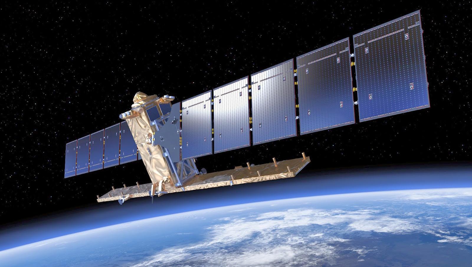
In the middle of last year, the BSEP delegation also had the opportunity to witness the launch of the Malaysia East Asia Satellite (MEASAT-3d) in Kourou, French Guiana, South America, using an Arianespace Ariane 5 launch vehicle.
MEASAT-3d is equipped with multiple communication channels to support current and future needs. In addition to the commonly used C-Band and Ku-Band for direct-to-home (DTH) services, telecommunications, and video delivery, MEASAT-3d also offers a High-Throughput Satellite (HTS) in the Ka-Band.
Meanwhile, in July last year, Singapore launched three satellites into orbit, with two of them dedicated to its security and defense.
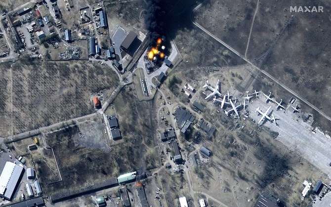
One of the satellites launched by Singapore is equipped with radar using radio waves that can capture high-resolution images even at night or in adverse weather conditions.
The satellite, named “NeuSAR,” is equipped with Synthetic Aperture Radar (SAR) to capture various Earth images.
In addition to “NeuSAR,” Singapore also launched a 360kg satellite developed by DS-EO, a collaboration between the Defense Science and Technology Agency (DSTA) and ST Engineering.
Like “NeuSAR,” the Earth Observation Satellite, a collaboration between DSTA and ST Engineering, is capable of capturing high-resolution and high-quality Earth images but is weather-dependent and operates only during daylight.
In 2021, there were reports stating that Vietnam had chosen an Israeli company to launch its national reconnaissance satellite into orbit.
Israel Aerospace Industries (IAI) was reported to have beaten several renowned international satellite manufacturing companies, including Thales Alenia Space, Airbus Defence and Space, and Lockheed Martin.
Vietnam’s reconnaissance satellite, also known as a “high-resolution imaging satellite,” has both civilian and military applications and is expected to take several years to construct before becoming operational.
IAI is expected to leverage its experience in building 16 Israeli reconnaissance satellites, known as “Ofek” (from Ofek-1 to Ofek-16), to successfully complete its satellite project with the Vietnamese government.
The Vietnamese reconnaissance satellite will be named “VNREDSat-2” and is designed to have more advanced specifications compared to the country’s first Earth observation satellite, “VNREDSat-1,” launched in 2013.
One of its main functions when operational will be the ability to observe and capture images at a spatial resolution of less than one meter.
Meanwhile, Shamsuddin was also asked about the cyber and electromagnetic threat scenario at the moment, and said, “The landscape of warfare has changed at this time. Physical warfare will only occur after cyberattacks are launched to disrupt the capabilities of command, control, communication, and information.”
“The cyber space is now a strategic domain. It will not end. It happens at all times and from all directions. Our task is to protect our systems and ensure that connectivity is always functional, and all systems can be accessed at all times,” he added. — DSA

DOWNLOAD APPS DEFENCE SECURITY ASIA
Sebarang pertanyaan tentang pengiklanan, boleh hubungi admin di/To advertise can contact admin at: [email protected]